Geospatial
Advertisement
FreeView v.10 3
Geomatica FreeView is a flexible data viewing tool supporting over 100 raster and vector formats for loading, viewing, selection, and enhancement. FreeView is useful for any geospatial data viewing application, and is freely distributable.
Advertisement
Geomatica FreeView v.9. 1. 2005
Geomatica FreeView is a flexible data viewing tool supporting over 100 raster and vector formats for loading, viewing, selection, and enhancement. FreeView is useful for any geospatial data viewing application, and is freely distributable.
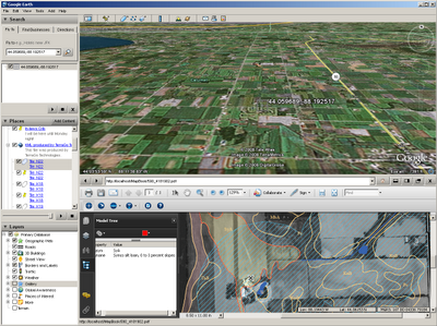
LizardTech GeoViewer v.5.0.0.3065
LizardTech GeoViewer is LizardTech's free, standalone application for viewing geospatial imagery, vector overlays, and LiDAR files.
ERDAS APOLLO Image Web Server 2011 v.11.0.1.250
ERDAS APOLLO Essentials - Image Web Server is a high-speed, specialized application that efficiently distributes massive amounts of geospatial imagery to thousands of users, all from a single server.
Cadcorp SIS Map Browser v.7 1
Cadcorp Map Browser is an application which allows the user to browse OGC® standard geographic data served on the web. Global demand for open systems interoperability is accelerating. Open Geospatial Consortium, Inc.
GeoServer v.2.2.3
GeoServer is an Open Source server that will allow you to connect your information to the Geospatial Web.
ERDAS Desktop 2011 v.11.0.3
ERDAS creates geospatial business systems that transform our earth's data into business information, enabling individuals, businesses and public agencies to quickly access, manage, process, and share that information from anywhere.
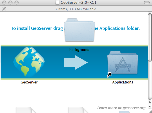
GeoServer for Mac v.2.2.3
GeoServer for Mac is an Open Source server that will allow you to connect your information to the Geospatial Web.
GeoServer for Linux v.2.2.3
GeoServer for Linux is an Open Source server that will allow you to connect your information to the Geospatial Web.
OpenEV v.1 80
OpenEV is a software library and application for viewing and analysing raster and vector geospatial data. OpenEV is used by private companies, universities, governments and non-profit organizations around the world.
SADA v.4. 1. 1950
Spatial Analysis and Decision Assistance (SADA) is free software that incorporates tools from environmental assessment fields into an effective problem solving environment.